

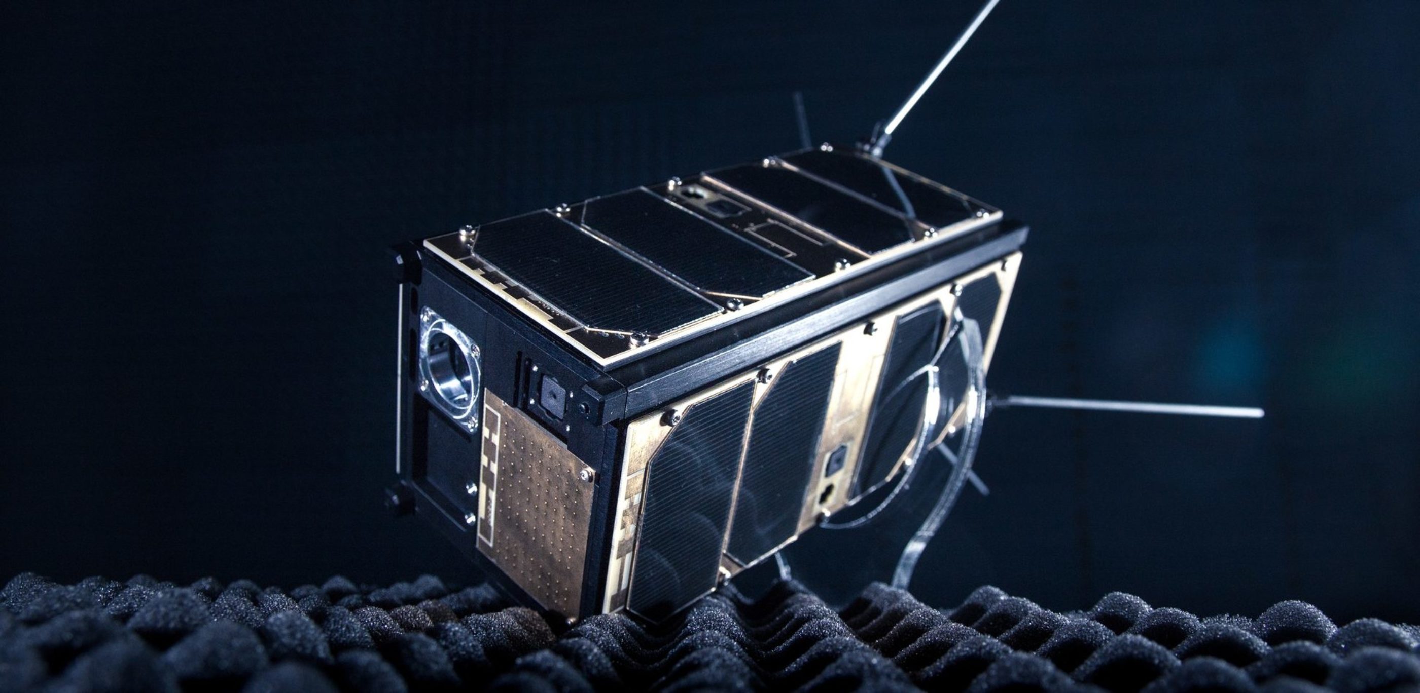
What if we could get a real-time feed from the middle of the Atlantic Ocean? Heat maps showing us gas leakages in the remotest areas of Siberia? Or continuous updates on the deforestation in the Amazon? Nanosatellites make all of that possible.
Weighing only a couple of kilograms, these small satellites are relatively cheap for companies and even some individuals to build. Nanosatellites now orbit the Earth in rapidly increasing numbers. In groups, nanosatellites can form constellations that provide critical data on our planet – with a low delay or, at best, in real time. They enable the radical global scaling of services, giving some business and citizens even the means to go prospecting the asteroid belt beyond Mars – perhaps to offer services on the Moon or nearby planets.
Shoot For the Moon: What Satellites Can Do For Business
The new space race is between companies.
Amazon, Uber, Facebook, and Walmart have ventured into satellite projects with partnerships or operations of their own. Amazon runs as-needed, pay-as-you-go AWS ground stations; Uber uses high-resolution satellite imaging for faster and more accurate updates on city infrastructure; Facebook is launching its internet satellite to provide broadband access to unserved and underserved regions; and Walmart has been using its private satellite network for decades, tracking inventory and sales and improving communications between stores.
What is notable is the range: Satellites create new opportunities in everything from retail to communications to mobility.
“Houston, we have liftoff!” – The ABCs of Making Business in Space
Cost-effective:
Satellites have become a viable business proposition for more companies than ever before
Far-reaching:
Satellites allow for blanket coverage of the world
Disruptive:
Satellites can provide near real-time information from anywhere on the planet and enable the scaling of services to global audiences
Paramount:
Satellites can help solve some of the most pressing environmental issues of our time
Warp Speeds: The Unprecedented Reach of Satellite Networks
Remote connections
Satellites render “in the middle of nowhere” obsolete. Distant places like farms, mines, and oil platforms are easier to connect to digital networks via satellite links than through wired and terrestrial wireless connections.
Self-directed traffic
Satellites help us find our way with GPS tools, showing us our position in relation to others. Satellites direct airplanes and large vessels –– helping them navigate sea ice and avoid collisions. Ultimately, satellites make possible a total global vehicular autonomy. Automated vehicles on land, sea, and air alike require situational awareness, connectivity, and location information to operate safely.
Environmental conservation
Satellites gather data that show patterns and trends in weather, crop growth, and soil moisture levels, helping us maximize food production and prepare for extreme weather. Satellites’ data can help us pick out abnormalities, too, making it possible to scan the globe for forest fires and even for illegal fishing vessels.
Optimized fuel consumption
Satellites monitor and regulate our fossil fuel consumption, enabling supply chains to implement just-in-time arrivals that minimize fuel burned en route.
Humanitarian help
Satellites are our first form of crisis management: They provide information used to direct relief efforts and move masses of people. Satellites make our wireless connections more robust amidst environmental crises.
Societal cohesion
Satellites provide important data on societies, helping to monitor poverty rates in developing countries and to prepare populations for issues like crop shortages. That aids in preventing conflict.

Back to Earth: Real-life Applications of Satellite Technology
Satellites’ crop monitoring translates to improved yields with less fertiliser. That means reduced need for farmland and less stress on the environment when creating your breakfast staples.
Satellites can offer the connectivity for banks’ systems to process credit card payments even in remote locations, like cruise ships. That means you can get your coffee to go, no matter where you are.
Crowdsourced traffic data, made possible with mobile devices knowing their location, allow you to always choose the quickest route to work. Your team will thank you for it. With satellite data, insurance companies can better asses risks for individuals and companies. They can track everything from private vehicles to entire fleets of ships and airplanes. You too will be better equipped to prevent your new car or motorcycle veering off course.
Who needs airplane mode? The seamless handover from terrestrial mobile network to the plane’s satellite network means you can carry on connected – or get some work done on the fly. And if you wonder when your friend will get off the flight, satellites can monitor air traffic to give you live updates on everything that’s still up the air.
Satellites can also tell you whether a factory yard is piling up with inventory or whether a hypermarket’s parking lot is usually full or empty. That information can transform your fortunes in the stock market.


